Take it from someone who does not understand weather nor forecasting: we are just about 7 days from the cruising division start and the weather for the Pacific Cup is improving!
Over the last few days I have looked at the PassageWeather.com charts for the Pacific Cup crossing and things look better than they did a few days ago. The site has a nice set of charts for the following 8 days. The only problem is that it is difficult to see a daily trend because the first few days have 8 charts per day and the last day of the model only 2.
So it took the whole set of charts, only kept the 0 UTC chart for each day (this also remove the day/night variations) and created the following animation:
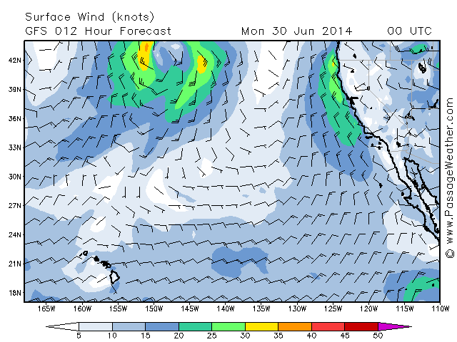
Next 8 days: click to animate
Clearly the wind pattern seems to be moving north, closer to the great circle route. Is that true or am I only seeing what I am hoping for?